 Credit: Adobe Stock
Experts from several Polish centres will develop a new type of tactile maps for the blind, which will allow them to better explore historic parks and gardens - not only determine the layout of alleys and greenery, but also learn about the historical style and other features.
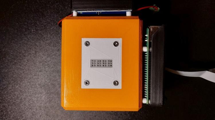
'Modern printing technology, 3D printing, can be used to print tactile maps that facilitate access to cultural goods for blind and visually impaired people', says Dr. Albina Mościcka, a professor at the Military University of Technology, leader of the research project 'Technology for the development of typhlo-maps of historic park layouts (TYFLOMAPY)'.
'So far, historic parks and gardens have not been given significant attention in terms of their accessibility for the blind, beyond the possibility of moving around and receiving natural impressions with the available senses', adds Dr. Emilia Śmiechowska-Petrovskij from the Faculty of Pedagogical Sciences of the Cardinal Stefan Wyszyński University in Warsaw, a typhlo-educator and member of the research team. She emphasizes that such people need tactile maps and plans that refer not only to the facilities of public institutions (as required by the Act on Accessibility), but also to public and recreational spaces, such as city parks.
As part of the project, scientists are working on the entire technology of developing tactile maps of historic gardens: from the concept (selection of the scope of content, development of a system of signs, editorial and generalization guidelines) through the method of execution to the printing technique. 'We are testing different methods, parameters and materials in 3D printing', says Mościcka. The tangible effect of using this technology will be prototypes of park tactile maps in five different styles, made with this technology.
'The tactile maps of parks that have been developed so far are mainly navigational maps that enable moving around the park, moving from one object to another', says Albina Mościcka. She explains that on such a map, one can see mainly a network of alleys and a lot of green colour, symbolizing the natural elements of the park. However, they do not show the most important thing in such gardens: the diversity of natural and architectural objects juxtaposed to form a harmonious whole.
'Meanwhile, each garden - depending on the period in which it was created - has other, differently located elements of small architecture and nature in its area. And these features make up the unique composition of the garden and determine its style', the expert emphasises.
The scientists want tactile maps to show those features of gardens that 'determine their style and uniqueness, and thus the beauty of each garden'.
'We treat tactile maps not as the basis for moving around the garden, but the basis for learning what features a garden has in the Baroque style (e.g. Park in Wilanów), and what features are in the Japanese style (Japanese Garden in Wrocław) or English style (Garden in Krasiczyn)', Mościska explains. She adds that 'it is difficult because maps for the blind must have highly generalized content, because it is read mainly by touch, the resolution of which is about ten times lower than the resolution of sight'.
'This means that it is only possible to fit very little highly simplified content on maps - much less than on maps for sighted people', emphasises Mościcka. The task of the researchers is to develop a way of selecting this content so that it conveys information about the features of the parks, and then present it using tactile signs - so that it is legible for a blind recipient.
The authors of the project emphasise that the added value is 3D printing, which gives freedom in designing tactile cartographic signs and enables the introduction of proprietary solutions that increase the legibility of the tactile maps themselves and their informative value. The project will use previous research on the use of 3D printing for the production of tactile maps conducted, among others, by Dr. Jakub Wabiński from the Military University of Technology.
The team members - in addition to surveyors from the Military University of Technology and a typhlo-educator from the Cardinal Stefan Wyszyński University - also include Dr. Anna Traut-Seliga, doctor of biological sciences and expert in the field of nature conservation from the Institute of Natural Sciences of the Stefan Batory Academy of Applied Sciences in Skierniewice.
The Typhlological Institute of the Polish Association of the Blind also participate in the project and organises research sessions. As a result, over the next two years, 20 blind and visually impaired people will participate in six test sessions. During these sessions, they will evaluate sets of tactile and graphic signs for tactile maps in various scales, as well as various tactile map printing techniques or final sets of maps of selected parks designed in specific styles. The sessions will be recorded, and the analysis of the obtained material will be used for scientific purposes.
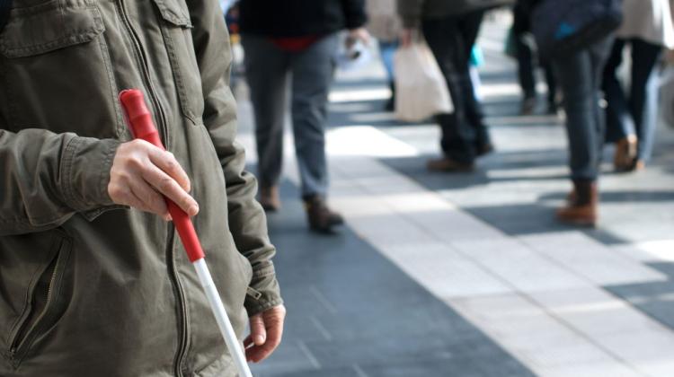
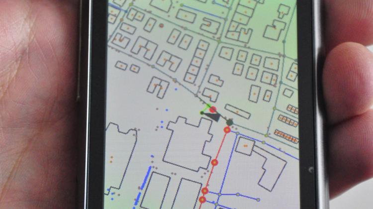
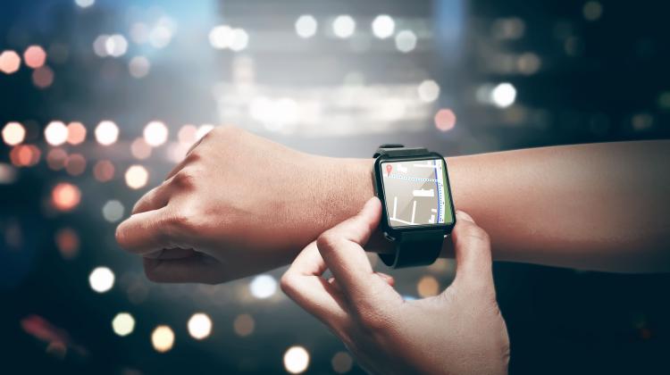
Today, blind and visually impaired people most often use technology (detection and navigation systems) in the form of smartphone applications.
Dr. Emilia Śmiechowska-Petrovskij emphasises that navigation is very popular among the blind. 'It is easily accessible, only slightly cost-intensive, does not require special equipment - a smartphone, an iPhone are considered by blind people as a separate rehabilitation aid, which also ensures discretion of use', she says. 'Nevertheless, blind people need slightly different information than sighted people, which is why they rate the most popular apps such as Google Maps or Apple Maps as insufficient, despite the amendments made to the description of pedestrian navigation'.
'Blind users need contextual information about the places they pass, the buildings and the surrounding area', describes the typhlo-educator. In her opinion, applications designed for visually impaired people are particularly important, as they supplement the description of space with the names of passed points, allowing to build a more complete mental map of the area. 'Blind people also often combine the several different navigation tools that provide different information', she reports.
The blind also use short-range beacon systems (in open and closed spaces). These transmitters allow to receive auditory information about the area through applications in phones. According to the typhlo-educator, this system requires further development, it has great potential, but is insufficiently used. She points out that in the open space of some cities, there is already a practice of placing electronic tags. The most popular ones include Totupoint, a short-range navigation and information system.
'Such electronic markers facilitate access to public information. They are currently installed in about 1,000 places in the country', she says. 'Thanks to direct communication with the user's smartphone, they provide information about the blind person's location, objects, but also dangerous spots, such as street repairs'.
The project 'Technology for the development of typhlo-maps of historic park layouts (TYFLOMAPY)' was nominated for the Polish Smart Development Award 2023 for pioneering research aimed at improving the accessibility of the tourist and cultural offer for the blind and visually impaired, contributing to improving their standard of living. The project is financed by the National Centre for Research and Development under the programme Rzeczy są dla ludzi ('Things are for people').
PAP - Science in Poland, Anna Mikołajczyk-Kłębek
amk/ zan/ kap/
tr. RL
Przed dodaniem komentarza prosimy o zapoznanie z Regulaminem forum serwisu Nauka w Polsce.